Download Continent Map PowerPoint Templates
-
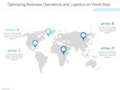 Optimizing business operations and logistics on world map ppt slide
Presenting optimizing business operations and logistics on world map ppt slide. This is a optimizing business operations and logistics on world map ppt slide. This is a four stage process. The stages in this process are business, strategy, location, globe, geography.
-
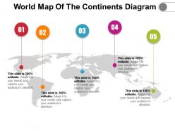 World map of the continents diagram
Presenting World Map Of The Continents Diagram. Change the colors, font type, font size, and the background of the slide as per choice and match it to your presentation theme. Get this readily available PPT template that is editable. Customize it as per your requirements. Convert it into various file formats, including JPG, PDF, and various other file formats. Present it in front of large audiences because of its splendid pixel quality. Enter the related content in the text placeholders.
-
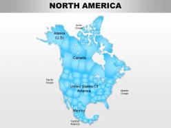 North america continents powerpoint maps
Useful for teachers, professors, businessmen, professionals in for-profit and nonprofit organization, tourism industry and many more. Conversion of slides to JPG and PDF formats an option. View slides in widescreen for different screens. PPT model slides compatible with google slides for effortless viewing. Great PowerPoint graphics with option to change features like shape, size and color of the icon/object.
-
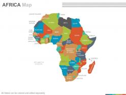 Maps of the african africa continent countries in powerpoint
These are absolutely progressive PowerPoint visuals providing an eternal experience to the viewers. These are trajectory placed PPT layouts, designs, shapes, maps, shades and figures etc. These PPT graphics can be congruent with Google slides and other operating programs. This PPT design provides enough storage space, These Presentation templates can also be easily exportable in to various setups. The stages in this process are morocco, niger, sudan, ethiopla, eritrea, comoros, angola.
-
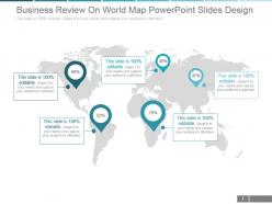 Business review on world map powerpoint slides design
Modify the presentation with business insignia and crest. Ready to use PowerPoint template assist you in saving time and effort. Include or exclude slide content as per your business need. Colors and text can be easily changed as the PPT design is smoothly amendable. Adjustable as can be converted in PDF or JPEG documents. Instant download and easy to share with large set of viewers. PowerPoint template downloadable in standard and widescreen display. Imaginatively crafted presentation slide with professional approach.
-
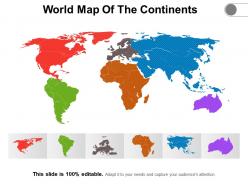 World map of the continents
Presenting World Map Of The Continents slideshow. You can easily download this into multiple images or document formats like JPEG and PDF. It supports both the standard and widescreen ratios. It is compatible with Google Slides and MS PowerPoint. Alter the style, size, background, and other attributes of the slide. High-quality graphics will ensure that distortion does not occur.
-
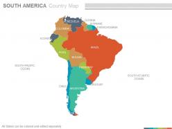 Maps of south america continent countries in powerpoint
The following map is a representation of a PPT slide which can be used for laying down your business location and geographical details in countries of south America and can be used by professionals for their PowerPoint presentations. You can alter the size of the map used in the image and also use location icons. Experience these Ppt slides in the full screen version after downloading. The stages in this process are south pacific ocean, ecuador, bolivia, argentina, brazil, uruguay, argentina.
-
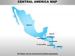 Central america continents powerpoint maps
Presenting Central America continents PowerPoint maps. Available both in standard and widescreen view. Easy to modify into JPEG or PDF document. Editable PowerPoint template designs to meet the industry requirements. Downloadable PPT design to insert data and share. Available in high quality resolution display. Useful for industry professionals, teachers, lawyers, students, strategists and management planners. Fully compatible with Google slides. Easy to download and saves valuable time and effort. Compatible with number of software options.
-
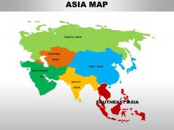 South east asia continents powerpoint maps
These high quality, editable powerpoint country maps have been carefully created by our professional team to display location and other geographic details in your PowerPoint presentation. Each map is vector based and is 100% editable in powerpoint. Each and every property of any region - color, size, shading etc can be modified to help you build an effective powerpoint presentation. Use these maps to show sales territories, business and new office locations, travel planning etc in your presentations. Any text can be entered at any point in the powerpoint map slide. Simply DOWNLOAD, TYPE and PRESENT!
-
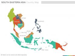 Maps of south eastern asia region continent countries in powerpoint
Following PPT slide can be used for business and marketing presentations by professionals from a diverse business background for displaying locations. After downloading this PowerPoint template you can explore the full version of the slides, which allows you to resize the map and fill countries in different colors and use location icon to portray your business location. The stages in this process are vietnam, brunei, indonesia, brunei, philippines, east timor, thailand.
-
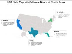 Usa state map with california new york florida texas
Presenting this set of slides with name - Usa State Map With California New York Florida Texas. This is a four stage process. The stages in this process are Usa State Map, Usa State Area, Usa State Location.
-
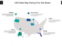 Usa state map having five text boxes
Presenting this set of slides with name - Usa State Map Having Five Text Boxes. This is a five stage process. The stages in this process are Usa State Map, Usa State Area, Usa State Location.
-
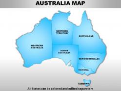 Australia continents powerpoint maps
These high quality, editable powerpoint country maps have been carefully created by our professional team to display location and other geographic details in your PowerPoint presentation. Each map is vector based and is 100% editable in powerpoint. Each and every property of any region - color, size, shading etc can be modified to help you build an effective powerpoint presentation. Use these maps to show sales territories, business and new office locations, travel planning etc in your presentations. Any text can be entered at any point in the powerpoint map slide. Simply DOWNLOAD, TYPE and PRESENT!
-
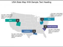 Usa state map with sample text heading
Presenting this set of slides with name - Usa State Map With Sample Text Heading. This is a four stage process. The stages in this process are Usa State Map, Usa State Area, Usa State Location.
-
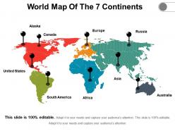 World map of the 7 continents
• Ease of download • Thoroughly editable slides. • High resolution visuals which do not decipher in quality when projected on wide screen. • Impressive picture quality. • Compatibility with numerous online and offline software options. • Compatible with multiple formats. • Ease of addition and exclusion of slide content as and when needed by the presenter. • Ease of including company specific name, logo and trademark for personalization • Used by geography students and teachers.
-
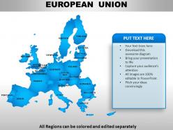 European union continents powerpoint maps
User friendly and highly organised PPT templates. Customization of Presentation graphics and diagrams according to desire and need. Fit into widescreen. Effortless conversion into PDF/ JPG format. Personalisation by insertion of company name, trademark or logo. Compatible with Google slides. Beneficial for multinational firms, diverse companies, travel planning, sales management, professors, teachers, students.
-
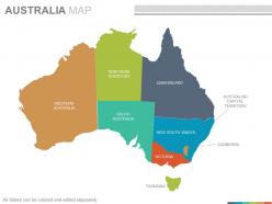 Maps of the australian australia continent countries in powerpoint
Presenting maps of the australian australia continent countries in powerpoint. This is a maps of the australian australia continent countries in powerpoint. The stages in this process are western australia, northern territory, south australia, queensland, new south wales, victoria, australian capital territory, canberra.
-
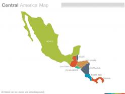 Maps of central american america region countries in powerpoint
Presenting maps of central american america region countries in powerpoint. This is a maps of central american america region countries in powerpoint. The stages in this process are mexico, guatemala, el salvador, belize, honduras, nicaragua, costa rica, panama.
-
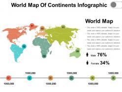 World map of continents infographic
Presenting world map of continents infographic. This is a world map of continents infographic. This is a six stage process. The stages in this process are world map of the continents, worldwide, continents map.
-
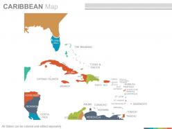 Maps in powerpoint showing caribbean region countries
Presenting maps in powerpoint showing caribbean region countries. This is a maps in powerpoint showing caribbean region countries. The stages in this process are florida usa, cayman islands, jamaica, aruba, costa rica, nicaragua, puerto rico.
-
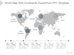 World map with continents powerpoint ppt template
Presenting world map with continents powerpoint ppt template. Presenting world map with continents powerpoint ppt template. This is a world map with continents powerpoint ppt template. This is a five stage process. The stages in this process are world map, continents, geographical, location, strategy.
-
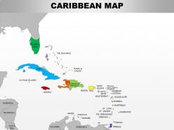 0714 caribbean region powerpoint maps showing bahamas haiti etc
Use of high-resolution, pixel friendly graphics in the slide design. Access to customize the entire ribbon of the slide icon. Allow to adjust the aspect ratio or the cropping of images. Offer insertion of elements from online platforms. Enjoy removing background and redesigning it. Functional for the business managers, marketing people, developers and relevant employees.
-
 Global business leadership team on world map powerpoint slide themes
Presenting global business leadership team on world map powerpoint slide themes. This is a global business leadership team on world map powerpoint slide themes. This is a five stage process. The stages in this process are charlie albert, sofia clark, kelly hansen, marcus owen, jessica disuza.
-
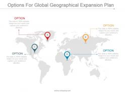 Options for global geographical expansion plan ppt slide examples
Presenting options for global geographical expansion plan PPT slide examples. Bright and informative PowerPoint presentation slides to gives regulations to achieve business targets. Predesigned formats to save time. Include your company logo and researched data by editing. Edit the color schemes, replace icons, change the font type and size. Convert the PPT design to pdf or jpeg formats needed. Compatible with Google slides and various offline and online options. Available in both standard 4:3 and widescreen format 16:9 after downloading. Download in a snap to explore full features.
-
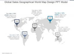 Global sales geographical world map design ppt model
Presenting global sales geographical world map design ppt model. This is a global sales geographical world map design ppt model. This is a five stage process. The stages in this process are location, business, strategy, marketing, analysis.
-
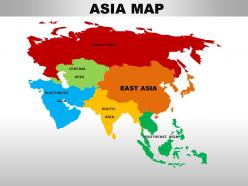 East asia continents powerpoint maps
These high quality, editable powerpoint country maps have been carefully created by our professional team to display location and other geographic details in your PowerPoint presentation. Each map is vector based and is 100% editable in powerpoint. Each and every property of any region - color, size, shading etc can be modified to help you build an effective powerpoint presentation. Use these maps to show sales territories, business and new office locations, travel planning etc in your presentations. Any text can be entered at any point in the powerpoint map slide. Simply DOWNLOAD, TYPE and PRESENT!
-
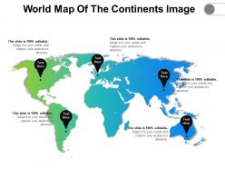 World map of the continents image
Presenting World Map Of the Continents Highlight Image. This slide is compatible with Google Slides, which is an added advantage. The slide is completely customizable in PowerPoint and other related software. Modify the font style, font color, and other components with ease. Transform this PPT into numerous documents or image formats like PDF or JPEG. High-quality graphics ensure that the picture quality is maintained.
-
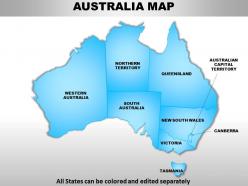 Australia continents powerpoint maps with act territory
We are proud to present our australia continents powerpoint maps with act territory. Our Australia Continents PowerPoint Maps with ACT Territory Power Point Templates Are Topically Designed To Provide An Attractive Backdrop To Any Subject. Use Them To Look Like A Presentation Pro. Use Our Australia Continents PowerPoint Maps with ACT Territory Power Point Templates To Effectively Help You Save Your Valuable Time. They Are Readymade To Fit Into Any Presentation Structure.
-
 Geographical Coverage Powerpoint Presentation Slides
Introducing Geographical Coverage PowerPoint Presentation Slides. This presentation includes 24 professionally designed PPT templates, all of them being 100 % editable in PowerPoint. Edit the fonts, colors, and slide background as per your needs. When you download the presentation, you get the templates in both widescreen and standard screen. The presentation is compatible with Google Slides and can be saved in JPG or PDF format.
-
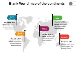 Blank world map of the continents
Presenting Blank World Map Of The Continents. The slide is completely customizable in PowerPoint and other related software. This slide is compatible with Google Slides, which is an added advantage. Modify the font style, font color, and other components with ease. Transform this PPT into numerous documents or image formats like PDF or JPEG. High-quality graphics ensure that the picture quality is maintained.
-
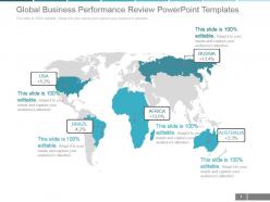 Global business performance review powerpoint templates
Presenting global business performance review powerpoint templates. This is a global business performance review powerpoint templates. This is a five stage process. The stages in this process are usa, russia, brazil, africa, australia.
-
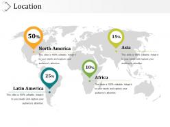 Location presentation diagrams
Presenting location presentation diagrams. This is a location presentation diagrams. This is a four stage process. The stages in this process are latin america, north america, africa, asia.
-
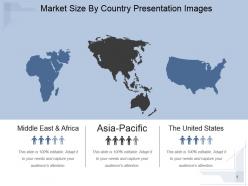 Market size by country presentation images
Presenting market size by country presentation images. This is a market size by country presentation images. This is a three stage process. The stages in this process are middle east and africa, asia pacific, asia pacific, the united states.
-
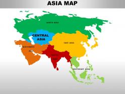 Central asia continents powerpoint maps
These high quality, editable powerpoint country maps have been carefully created by our professional team to display location and other geographic details in your PowerPoint presentation. Each map is vector based and is 100% editable in powerpoint. Each and every property of any region - color, size, shading etc can be modified to help you build an effective powerpoint presentation. Use these maps to show sales territories, business and new office locations, travel planning etc in your presentations. Any text can be entered at any point in the powerpoint map slide. Simply DOWNLOAD, TYPE and PRESENT!
-
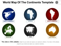 World map of the continents template
Presenting World Map Of The Continents Template. The slide is completely customizable in PowerPoint and other related software. This slide is compatible with Google Slides, which is an added advantage. Modify the font style, font color, and other components with ease. Transform this PPT into numerous documents or image formats like PDF or JPEG. High-quality graphics ensure that the picture quality is maintained.
-
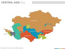 Maps of the central asia region continent countries in powerpoint
Presenting maps of the central asia region continent countries in powerpoint. This is a maps of the central asia region continent countries in powerpoint. The stages in this process are kazakhstan, uzbekistan, turkmenistan, tajikistan, armenia, caspian sea, georgia, uzbekistan.
-
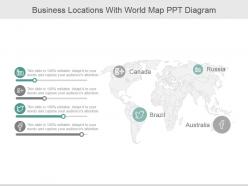 Business locations with world map ppt diagram
Presenting business locations with world map ppt diagram. This is a business locations with world map ppt diagram. This is a four stage process. The stages in this process are canada, russia, brazil, australia.
-
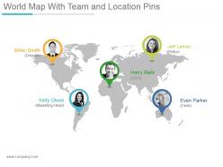 World map with team and location pins powerpoint themes
Presenting world map with team and location pins powerpoint themes. This is a world map with team and location pins powerpoint themes. This is a five stage process. The stages in this process are miller smith director, jeff lehrer editor, harry bails ceo, kelly olson marketing head, even parker clerk.
-
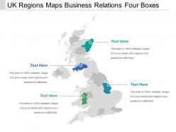 Uk regions maps business relations four boxes
Presenting this set of slides with name - Uk Regions Maps Business Relations Four Boxes. This is a one stage process. The stages in this process are Uk Regions, Uk Map, Uk Area.
-
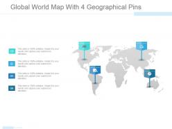 Global world map with 4 geographical pins powerpoint slide themes
Presenting global world map with 4 geographical pins powerpoint slide themes. This is a global world map with 4 geographical pins powerpoint slide themes. This is a four stage process. The stages in this process are world, location, globe, continent, icons.
-
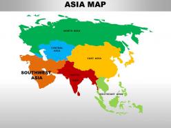 South asia continents powerpoint maps
These high quality, editable powerpoint country maps have been carefully created by our professional team to display location and other geographic details in your PowerPoint presentation. Each map is vector based and is 100% editable in powerpoint. Each and every property of any region - color, size, shading etc can be modified to help you build an effective powerpoint presentation. Use these maps to show sales territories, business and new office locations, travel planning etc in your presentations. Any text can be entered at any point in the powerpoint map slide. Simply DOWNLOAD, TYPE and PRESENT!
-
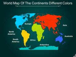 World map of the continents different colors
Presenting World Map Of The Continents Different Colors slideshow. You can easily download this into multiple images or document formats like JPEG and PDF. It supports both the standard and widescreen ratios. It is compatible with Google Slides and MS PowerPoint. Alter the style, size, background, and other attributes of the slide. High-quality graphics will ensure that distortion does not occur.
-
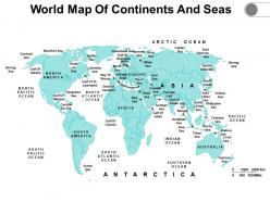 World map of continents and seas
Presenting our World Map Of Continents And Seas PowerPoint Presentation Slide. The template is fully editable in PowerPoint and compatible with Google Slides as well. You can adapt the slideshow according to your unique business requirements. Add your text, image, or icon with ease. The template can be converted into different formats such as JPG, PDF, etc. without any hassle. High-quality graphics ensure an attention-grabbing presentation. Additionally, it is available in both 4:3 and 16:9 aspect ratios.
-
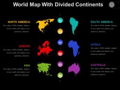 World map with divided continents
Presenting Centre World Map With Four Location Points. The slide is completely customizable in PowerPoint and other related software. This slide is compatible with Google Slides, which is an added advantage. Modify the font style, font color, and other components with ease. Transform this PPT into numerous documents or image formats like PDF or JPEG. High-quality graphics ensure that the picture quality is maintained.
-
 Gps map with start end location route
Presenting this set of slides with name - Gps Map With Start End Location Route. This is a three stage process. The stages in this process are Gps Map, Gps Navigation, Gps Location.
-
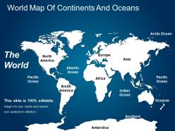 World map of continents and oceans
Presenting World Map Of Continents And Oceans Template. The slide is completely customizable in PowerPoint and other related software. This slide is compatible with Google Slides, which is an added advantage. Modify the font style, font color, and other components with ease. Transform this PPT into numerous documents or image formats like PDF or JPEG. High-quality graphics ensure that the picture quality is maintained.
-
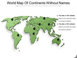 World map of continents without names
Presenting world map of continents without names. This is a world map of continents without names. This is a eight stage process. The stages in this process are world map of the continents, worldwide, continents map.
-
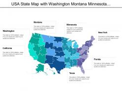 Usa state map with washington montana minnesota new york texas
Presenting this set of slides with name - Usa State Map With Washington Montana Minnesota New York Texas. This is a seven stage process. The stages in this process are Usa State Map, Usa State Area, Usa State Location.
-
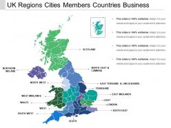 Uk regions cities members countries business
Presenting this set of slides with name - Uk Regions Cities Members Countries Business. This is a one stage process. The stages in this process are Uk Regions, Uk Map, Uk Area.
-
 Gps map with navigation pin icon
Presenting this set of slides with name - Gps Map With Navigation Pin Icon. This is a one stage process. The stages in this process are Gps Map, Gps Navigation, Gps Location.
-
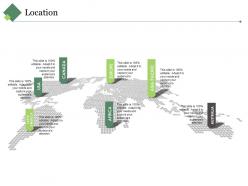 Location ppt summary slideshow
Presenting this set of slides with name - Location Ppt Summary Slideshow. This is a seven stage process. The stages in this process are Latin America, Usa, Canada, Africa, Europe, Asia Pacific.
-
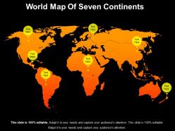 World map of seven continents
Presenting world map of seven continents. This is a world map of seven continents. This is a seven stage process. The stages in this process are world map of the continents, worldwide, continents map.
-
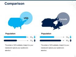 Comparison ppt sample download
Presenting this set of slides with name - Comparison Ppt Sample Download. This is a two stage process. The stages in this process are Comparison, Location, Geography, Management, Business.
-
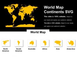 World map continents svg
Presenting world map continents svg. This is aworld map continents svg. This is a six stage process. The stages in this process are world map of the continents, worldwide, continents map.
-
 Gps tracking with bus and locator
Presenting this set of slides with name - Gps Tracking With Bus And Locator. This is a four stage process. The stages in this process are Gps Tracking, Location Tracking, Navigation.
-
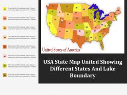 Usa state map united showing different states and lake boundary
Presenting this set of slides with name - Usa State Map United Showing Different States And Lake Boundary. This is a one stage process. The stages in this process are Usa State Map, Usa State Area, Usa State Location.
-
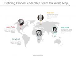 Defining global leadership team on world map ppt images
Presenting defining global leadership team on world map ppt images. This is a defining global leadership team on world map ppt images. This is a four stage process. The stages in this process are adam tucker, marry smith, peter clark, anita sweet.
-
 Editable world map with pointers geographical powerpoint ideas
Presenting editable world map with pointers geographical powerpoint ideas. This is a editable world map with pointers geographical powerpoint ideas. This is a five stage process. The stages in this process are location, geographical, information, map, strategy.
-
 Gps tracking path showing destination
Presenting this set of slides with name - Gps Tracking Path Showing Destination. This is a four stage process. The stages in this process are Gps Tracking, Location Tracking, Navigation.
-
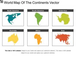 World map of the continents vector
Presenting world map of the continents vector. This is a world map of the continents vector. This is a six stage process. The stages in this process are world map of the continents, worldwide, continents map.


