PowerPoint Maps Templates, Presentation Slides and World PPT Graphics
-
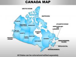 Canada country powerpoint maps
These high quality, editable powerpoint state maps have been carefully created by our professional team to display location and other geographic details in your PowerPoint presentation. Each map is vector based and is 100% editable in powerpoint. Each and every property of any region - color, size, shading etc can be modified to help you build an effective powerpoint presentation. Use these maps to show sales territories, business and new office locations, travel planning etc in your presentations. Any text can be entered at any point in the powerpoint map slide. Simply DOWNLOAD, TYPE and PRESENT!
-
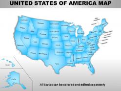 Usa country powerpoint maps
Skillfully designed USA country PowerPoint map suitable for professionals from diverse sectors i.e. scholars, teachers, business professionals, researchers, etc. Personalize it with brand name and logo of your own. Enough space available to put dummy content. Manually editable presentation graphics, text, font, colors, layout, region and shading. Use these maps to show sales territories, business and new office locations, travel planning etc. in your presentations. Well adaptable with all the software’s and Google slides. High resolution PowerPoint template theme. Simply click to add logo, trademark or name. Flexibility to convert in PDF or JPG form.
-
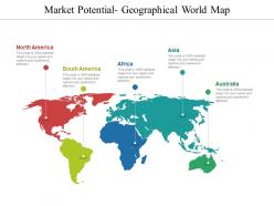 Market Potential Geographical World Map Presentation Ideas
Presenting market potential geographical world map presentation ideas. This is a market potential geographical world map presentation ideas. This is a four stage process. The stages in this process are market overview, market assessments, market potential .
-
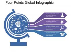 Four Points Global Infographic
Presenting this set of slides with name - Four Points Global Infographic. This is a four stage process. The stages in this process are Global Infographic, International Infographic, Worldwide Inforgraphic.
-
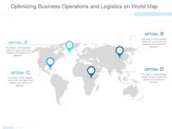 Optimizing business operations and logistics on world map ppt slide
Presenting optimizing business operations and logistics on world map ppt slide. This is a optimizing business operations and logistics on world map ppt slide. This is a four stage process. The stages in this process are business, strategy, location, globe, geography.
-
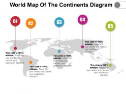 World map of the continents diagram
Presenting World Map Of The Continents Diagram. Change the colors, font type, font size, and the background of the slide as per choice and match it to your presentation theme. Get this readily available PPT template that is editable. Customize it as per your requirements. Convert it into various file formats, including JPG, PDF, and various other file formats. Present it in front of large audiences because of its splendid pixel quality. Enter the related content in the text placeholders.
-
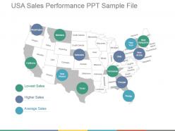 Usa sales performance ppt sample file
Fully editable USA sales performance PPT sample file presentation slideshow. Crafted using latest tools and techniques. These are trending these days due to their unique style. They can easily be converted to different file formats such as Jpeg and Pdf. They can be viewed in wide screens for more clear vision. They are result and technology oriented. They easily adapt the changes and work accordingly. Entirely compatible PPT slides with Google Slides. Presentation templates are easily modifiable as required.
-
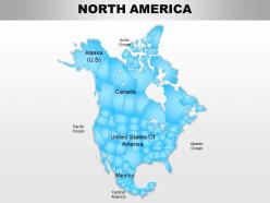 North america continents powerpoint maps
Useful for teachers, professors, businessmen, professionals in for-profit and nonprofit organization, tourism industry and many more. Conversion of slides to JPG and PDF formats an option. View slides in widescreen for different screens. PPT model slides compatible with google slides for effortless viewing. Great PowerPoint graphics with option to change features like shape, size and color of the icon/object.
-
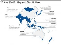 Asia pacific map with text holders
Presenting this set of slides with name - Asia Pacific Map With Text Holders. This is a one stage process. The stages in this process are Asia Pacific Map, Countries.
-
 United states country powerpoint flags
These high quality, editable powerpoint country flags have been carefully created by our professional team to display location and other geographic details in your PowerPoint presentation. Each flag is vector based and is 100% editable in powerpoint. Each and every property of any region - color, size, shading etc can be modified to help you build an effective powerpoint presentation. Use these flags to show sales territories, business and new office locations, travel planning etc in your presentations. Any text can be entered at any point in the powerpoint flag slide. Simply DOWNLOAD, TYPE and PRESENT!
-
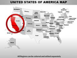 Usa california state powerpoint maps
These high quality, editable powerpoint state maps have been carefully created by our professional team to display location and other geographic details in your PowerPoint presentation. Each map is vector based and is 100% editable in powerpoint. Each and every property of any region - color, size, shading etc can be modified to help you build an effective powerpoint presentation. Use these maps to show sales territories, business and new office locations, travel planning etc in your presentations. Any text can be entered at any point in the powerpoint map slide. Simply DOWNLOAD, TYPE and PRESENT!
-
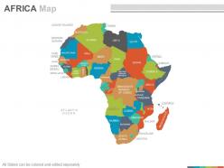 Maps of the african africa continent countries in powerpoint
These are absolutely progressive PowerPoint visuals providing an eternal experience to the viewers. These are trajectory placed PPT layouts, designs, shapes, maps, shades and figures etc. These PPT graphics can be congruent with Google slides and other operating programs. This PPT design provides enough storage space, These Presentation templates can also be easily exportable in to various setups. The stages in this process are morocco, niger, sudan, ethiopla, eritrea, comoros, angola.
-
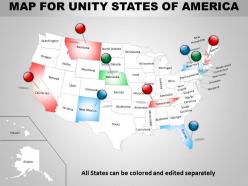 Map for united states of america ppt presentation slides
Unique presentation of business concept. Adjustable with multiple topics related to sales and marketing. Compatible with numerous format options. Harmonious with big set of software. High resolution. No issue of pixilation when projected on wide screen. 100 percent editable. Modify the slide content as per individual preference. Personalize the presentation with company name and logo. Used by marketers, financiers, HR professionals, sales people, students and teachers.
-
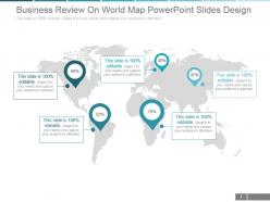 Business review on world map powerpoint slides design
Modify the presentation with business insignia and crest. Ready to use PowerPoint template assist you in saving time and effort. Include or exclude slide content as per your business need. Colors and text can be easily changed as the PPT design is smoothly amendable. Adjustable as can be converted in PDF or JPEG documents. Instant download and easy to share with large set of viewers. PowerPoint template downloadable in standard and widescreen display. Imaginatively crafted presentation slide with professional approach.
-
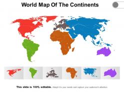 World map of the continents
Presenting World Map Of The Continents slideshow. You can easily download this into multiple images or document formats like JPEG and PDF. It supports both the standard and widescreen ratios. It is compatible with Google Slides and MS PowerPoint. Alter the style, size, background, and other attributes of the slide. High-quality graphics will ensure that distortion does not occur.
-
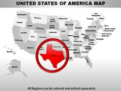 Usa texas state powerpoint maps
Uncomplicated download link • Effortless editing possible with detailed instruction to execute the editing if and when desired. • Facile inclusion and exclusion of content to personalize and customize the presentation. • Higher aspect ratio of the slides does not deter its visual quality. • 100 editable and customizable. • Compatible with varied software and Google slides. • Congruent with multiple formats like JPEG, JPG or PDF. • International business connected employees or business analyst or students and teachers can bring out and deliver a flawless presentation with this Texas state PPT presentation model.
-
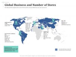 Scale up your company through series b investment global business and number of stores
This slide provides the global store count of North America, Europe, Middle East, Asia, Latin America etc. Introducing Scale Up Your Company Through Series B Investment Global Business And Number Of Stores to increase your presentation threshold. Encompassed with five stages, this template is a great option to educate and entice your audience. Dispence information on Global Business And Number Of Stores, using this template. Grab it now to reap its full benefits.
-
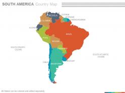 Maps of south america continent countries in powerpoint
The following map is a representation of a PPT slide which can be used for laying down your business location and geographical details in countries of south America and can be used by professionals for their PowerPoint presentations. You can alter the size of the map used in the image and also use location icons. Experience these Ppt slides in the full screen version after downloading. The stages in this process are south pacific ocean, ecuador, bolivia, argentina, brazil, uruguay, argentina.
-
 Rd business peoples with world map flat powerpoint design
PPT slide can be used by businessmen, micro, small and medium enterprises as a master slide, as the face of the company. Supports filling background in a different color from the text. All images are 100% editable in the presentation slide. Changing the color, size and orientation in PPT design of any icon to your liking is very easy and handy.
-
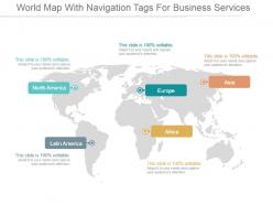 World map with navigation tags for business services ppt slide styles
Presenting world map with navigation tags for business services ppt slide styles. This is a world map with navigation tags for business services ppt slide styles. This is a five stage process. The stages in this process are north america, europe, asia, latin america, africa.
-
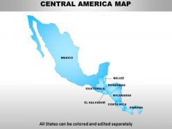 Central america continents powerpoint maps
Presenting Central America continents PowerPoint maps. Available both in standard and widescreen view. Easy to modify into JPEG or PDF document. Editable PowerPoint template designs to meet the industry requirements. Downloadable PPT design to insert data and share. Available in high quality resolution display. Useful for industry professionals, teachers, lawyers, students, strategists and management planners. Fully compatible with Google slides. Easy to download and saves valuable time and effort. Compatible with number of software options.
-
 World map with business peoples network ppt presentation slides
Absolutely adaptable Presentation slide as can be customized. Good use of colors and shapes to create awesome designs. PowerPoint template can be displayed in standard and widescreen view. PPT layout is customizable as commerce details can be added. Easy to download and change into PDF format. Compatible with software options such as JPEG and PDF. PowerPoint diagram goes well with Google slides that make the design beneficial. PPT graphic can be downloaded and shared as printouts.
-
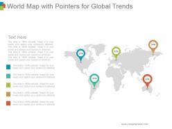 World map with pointers for global trends
Presenting world map with pointers for global trends. This is a world map with pointers for global trends. This is a five stage process. The stages in this process are map, process, business, location, information.
-
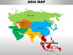 South east asia continents powerpoint maps
These high quality, editable powerpoint country maps have been carefully created by our professional team to display location and other geographic details in your PowerPoint presentation. Each map is vector based and is 100% editable in powerpoint. Each and every property of any region - color, size, shading etc can be modified to help you build an effective powerpoint presentation. Use these maps to show sales territories, business and new office locations, travel planning etc in your presentations. Any text can be entered at any point in the powerpoint map slide. Simply DOWNLOAD, TYPE and PRESENT!
-
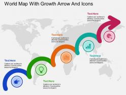 World map with growth arrow and icons flat powerpoint design
User friendly and highly organised PPT templates. Customization of Presentation graphics and diagrams according to desire and need. Fit into widescreen. Pre designed and high resolution graphics. Effortless conversion into PDF/ JPG format. Personalisation by insertion of company name, trademark or logo. Compatible with Google slides. Beneficial for multinational firms, diverse companies, travel planning, sales management, professors, teachers, students.
-
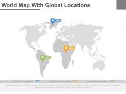 World map with global locations powerpoint slides
Presenting world map with global locations powerpoint slides. This Power Point template diagram slide has been crafted with world map and global locations. This PPT slide contains the concept of global business analysis. Use this PPT slide for business and marketing related presentations.
-
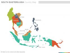 Maps of south eastern asia region continent countries in powerpoint
Following PPT slide can be used for business and marketing presentations by professionals from a diverse business background for displaying locations. After downloading this PowerPoint template you can explore the full version of the slides, which allows you to resize the map and fill countries in different colors and use location icon to portray your business location. The stages in this process are vietnam, brunei, indonesia, brunei, philippines, east timor, thailand.
-
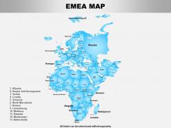 Emea powerpoint maps
Presenting this set of slides with name Emea Powerpoint Maps. The topics discussed in these slides are Map, Country. This is a completely editable PowerPoint presentation and is available for immediate download. Download now and impress your audience.
-
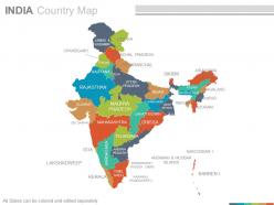 India country powerpoint maps
Presenting india country powerpoint maps. These high quality, editable powerpoint state maps have been carefully created by our professional team to display location and other geographic details in your PowerPoint presentation. Each map is vector based and is 100 percent editable in powerpoint. Each and every property of any region - color, size, shading etc can be modified to help you build an effective powerpoint presentation. Use these maps to show sales territories, business and new office locations, travel planning etc in your presentations. Any text can be entered at any point in the powerpoint map slide. Simply DOWNLOAD, TYPE and PRESENT.
-
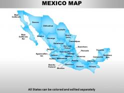 Mexico country powerpoint maps
These high quality, editable powerpoint state maps have been carefully created by our professional team to display location and other geographic details in your PowerPoint presentation. Each map is vector based and is 100% editable in powerpoint. Each and every property of any region - color, size, shading etc can be modified to help you build an effective powerpoint presentation. Use these maps to show sales territories, business and new office locations, travel planning etc in your presentations. Any text can be entered at any point in the powerpoint map slide. Simply DOWNLOAD, TYPE and PRESENT!
-
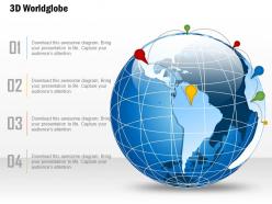 0914 business plan 3d world globe with location icons line powerpoint presentation template
Watchfully crafted PowerPoint illustration. High quality of Presentation visual graphics. Picture quality don't pixelate when projected on wide screen. Seamlessly blend with other software programs such as JPG and PDF. Alternate to modify the slide as color, text and layout can be edited. Presentation image attuned well with Google slides. Modify the PPT template by adding company insignia, icon, and image.
-
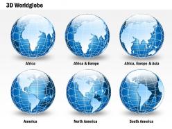 0914 business plan 3d blue glossy continents specialized globes powerpoint presentation template
We are proud to present our 0914 business plan 3d blue glossy continents specialized globes powerpoint presentation template. This business power point image has been designed to display 3d blue glossy globe graphics. In this image, we have used graphic of globe with highlighted continents. Display business and marketing activity for these continents by using this exclusive image.
-
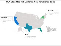 Usa state map with california new york florida texas
Presenting this set of slides with name - Usa State Map With California New York Florida Texas. This is a four stage process. The stages in this process are Usa State Map, Usa State Area, Usa State Location.
-
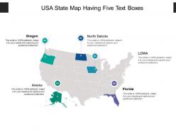 Usa state map having five text boxes
Presenting this set of slides with name - Usa State Map Having Five Text Boxes. This is a five stage process. The stages in this process are Usa State Map, Usa State Area, Usa State Location.
-
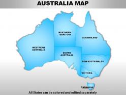 Australia continents powerpoint maps
These high quality, editable powerpoint country maps have been carefully created by our professional team to display location and other geographic details in your PowerPoint presentation. Each map is vector based and is 100% editable in powerpoint. Each and every property of any region - color, size, shading etc can be modified to help you build an effective powerpoint presentation. Use these maps to show sales territories, business and new office locations, travel planning etc in your presentations. Any text can be entered at any point in the powerpoint map slide. Simply DOWNLOAD, TYPE and PRESENT!
-
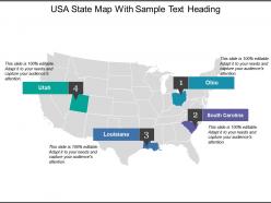 Usa state map with sample text heading
Presenting this set of slides with name - Usa State Map With Sample Text Heading. This is a four stage process. The stages in this process are Usa State Map, Usa State Area, Usa State Location.
-
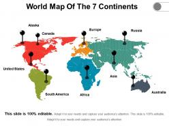 World map of the 7 continents
• Ease of download • Thoroughly editable slides. • High resolution visuals which do not decipher in quality when projected on wide screen. • Impressive picture quality. • Compatibility with numerous online and offline software options. • Compatible with multiple formats. • Ease of addition and exclusion of slide content as and when needed by the presenter. • Ease of including company specific name, logo and trademark for personalization • Used by geography students and teachers.
-
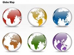 0914 business plan 3d colorful particular location globes powerpoint presentation template
We are proud to present our 0914 business plan 3d colorful particular location globes powerpoint presentation template. This Power Point diagram slide has been designed with 3d colorful location globe. Display multiple business locations on map for business . Build presentations on business strategy and marketing issues for multiple location.
-
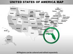 Usa florida state powerpoint maps
These high quality, editable powerpoint state maps have been carefully created by our professional team to display location and other geographic details in your PowerPoint presentation. Each map is vector based and is 100% editable in powerpoint. Each and every property of any region - color, size, shading etc can be modified to help you build an effective powerpoint presentation. Use these maps to show sales territories, business and new office locations, travel planning etc in your presentations. Any text can be entered at any point in the powerpoint map slide. Simply DOWNLOAD, TYPE and PRESENT!
-
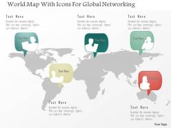 As world map with icons for global networking powerpoint template
Better quality graphics retain clarity even when displayed on a bigger screen. No scope for pixilation and excellent compatibility with Google slides and other common softwares. No space constraints hence full liberty to add titles or sub-titles. Changeable into PDF or JPEG format according to your convenience. Excellent tool for social media entities and businesses that operate at a global level.
-
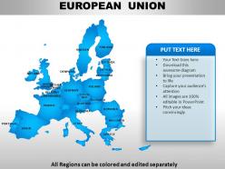 European union continents powerpoint maps
User friendly and highly organised PPT templates. Customization of Presentation graphics and diagrams according to desire and need. Fit into widescreen. Effortless conversion into PDF/ JPG format. Personalisation by insertion of company name, trademark or logo. Compatible with Google slides. Beneficial for multinational firms, diverse companies, travel planning, sales management, professors, teachers, students.
-
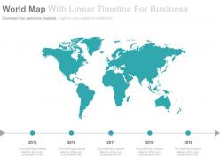 World map with linear timeline for business powerpoint slides
Easy to utilize fine quality PPT designs. Simple customization of shading, size, substance and presentation of each image and practical. Easy thought or denial of data as per demand. Personalization by extension of association name, trademark or logo. Simple to change over into JPEG or PDF mastermind. Easiest to download in your presentation. Standard and widescreen demonstrate choices. Profitable for business coordinators, business directors, advancing and financial authorities, strategists, instructors, understudies.
-
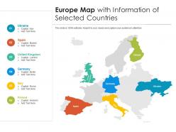 Europe map with information of selected countries
Introducing our premium set of slides with Europe Map With Information Of Selected Countries. Elucidate the six stages and present information using this PPT slide. This is a completely adaptable PowerPoint template design that can be used to interpret topics like Europe Map With Information Of Selected Countries. So download instantly and tailor it with your information.
-
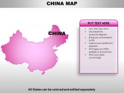 China country powerpoint maps
These high quality, editable powerpoint country maps have been carefully created by our professional team to display location and other geographic details in your PowerPoint presentation. Each map is vector based and is 100% editable in powerpoint. Each and every property of any region - color, size, shading etc can be modified to help you build an effective powerpoint presentation. Use these maps to show sales territories, business and new office locations, travel planning etc in your presentations. Any text can be entered at any point in the powerpoint map slide. Simply DOWNLOAD, TYPE and PRESENT!
-
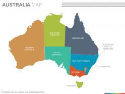 Maps of the australian australia continent countries in powerpoint
Presenting maps of the australian australia continent countries in powerpoint. This is a maps of the australian australia continent countries in powerpoint. The stages in this process are western australia, northern territory, south australia, queensland, new south wales, victoria, australian capital territory, canberra.
-
 1014 business plan vision text with globe text graphic powerpoint presentation template
We are proud to present our 1014 business plan vision text with globe text graphic powerpoint presentation template. This image slide displays vision text with globe. This business template has been crafted with globe in vision text graphic. You may use this image slide, in your presentation to express views on global business, vision, planning, globalization, trade, global industry and business management. Create outstanding presentations using this image slide.
-
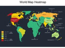 World map heatmap
Presenting World Map Heatmap PowerPoint slide. This PPT presentation is Google Slides compatible hence it is easily accessible. You can download and save this PowerPoint layout in different formats like PDF, PNG and JPG. This PPT theme is available in both 4:3 and 16:9 aspect ratios. This PowerPoint template is customizable so you can modify the font size, font type, color and shapes as per your requirements.
-
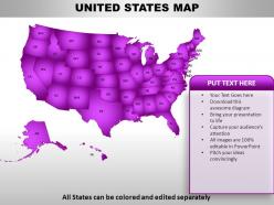 United states country powerpoint maps
These high quality, editable powerpoint country maps have been carefully created by our professional team to display location and other geographic details in your PowerPoint presentation. Each map is vector based and is 100% editable in powerpoint. Each and every property of any region - color, size, shading etc can be modified to help you build an effective powerpoint presentation. Use these maps to show sales territories, business and new office locations, travel planning etc in your presentations. Any text can be entered at any point in the powerpoint map slide. Simply DOWNLOAD, TYPE and PRESENT!
-
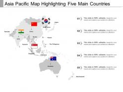 Asia pacific map
Presenting this set of slides with name - Asia Pacific Map. This is a one stage process. The stages in this process are Asia Pacific Map, Countries.
-
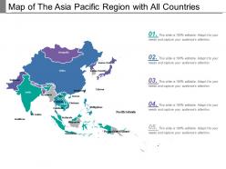 Map of the asia pacific region with all countries
Presenting this set of slides with name - Map Of The Asia Pacific Region With All Countries. This is a one stage process. The stages in this process are Asia Pacific Map, Countries.
-
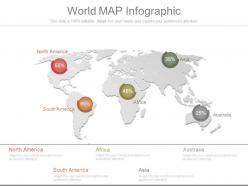 Unique world map infographic
High resolution PPT example. Easy to edit and customize PPT graphics. Compatible with all software and can be saved in any format (JPEG/JPG/PDF). Useful tool for students, business analysts and professionals of any and every industry. Precise and easy to comprehend information on PPT sample. Freedom to personalize the content with company name and logo. Hassle free addition and deletion of content as per need. The stages in this process are north america, south america, africa, australia, asia.
-
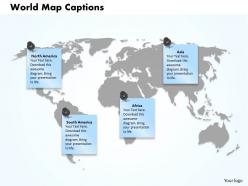 World map captions powerpoint template slide
Easy to download and save in the Jpg or PDF format. Access to open on a wide screen view. Allow editing or replacing of the icons. Offer to change the content, size, style and orientation of the slide icons. Provided instructions to change and edit the slide icon. Useful for the doctors, surgeons and related staff of hospital.
-
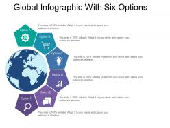 Global infographic with six options
Presenting this set of slides with name - Global Infographic With Six Options. This is a six stage process. The stages in this process are Global Infographic, International Infographic, Worldwide Inforgraphic.
-
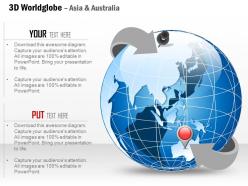 0914 business plan 3d world globe with location pins on asia and europe powerpoint presentation template
We are proud to present our 0914 business plan 3d world globe with location pins on asia and europe powerpoint presentation template. Display the exact location of any country in your business presentations with this exclusive power point image template. We have used graphic of 3d world globe and location icons with pins on Asia and Europe. Use this image for business and marketing agendas for Asia and Europe.
-
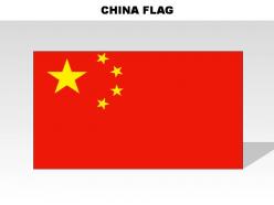 China country powerpoint flags
These high quality, editable powerpoint country flags have been carefully created by our professional team to display location and other geographic details in your PowerPoint presentation. Each flag is vector based and is 100% editable in powerpoint. Each and every property of any region - color, size, shading etc can be modified to help you build an effective powerpoint presentation. Use these flags to show sales territories, business and new office locations, travel planning etc in your presentations. Any text can be entered at any point in the powerpoint flag slide. Simply DOWNLOAD, TYPE and PRESENT!
-
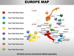 Interactive map of europe 1114
Ready to use PowerPoint map template. 100% editable presentation map. Text, font, colors and orientation can be easily changes as per your business requirements. Unaffected high resolution PPT slides even after customization. Well compatible with all the software’s and Google slides. Convertible into PDF or JPG formats. Useful for business presenters, politicians, corporate leaders, students, professors, etc.
-
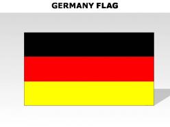 Germany country powerpoint flags
These high quality, editable powerpoint country flags have been carefully created by our professional team to display location and other geographic details in your PowerPoint presentation. Each flag is vector based and is 100% editable in powerpoint. Each and every property of any region - color, size, shading etc can be modified to help you build an effective powerpoint presentation. Use these flags to show sales territories, business and new office locations, travel planning etc in your presentations. Any text can be entered at any point in the powerpoint flag slide. Simply DOWNLOAD, TYPE and PRESENT!
-
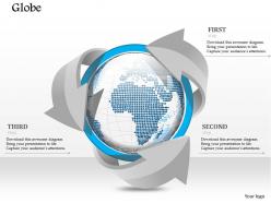 1014 business plan globe surrounded with arrows powerpoint presentation template
Great quality visual output without the issue of pixilation. Ensures professionalism in designing and presentation. Clarity of message. Ease of incorporating personalized content like name, logo and trademark. Ease of revising the PPT text, icons, colors, background, etc as per individual preference and need. Congruous with populous software options available online and offline. Can be adapted to any format of your choice. Widely used by multinational organizations, entrepreneurs, global marketers, students and professors.
-
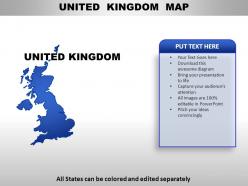 United kingdom country powerpoint maps
These high quality, editable powerpoint country maps have been carefully created by our professional team to display location and other geographic details in your PowerPoint presentation. Each map is vector based and is 100% editable in powerpoint. Each and every property of any region - color, size, shading etc can be modified to help you build an effective powerpoint presentation. Use these maps to show sales territories, business and new office locations, travel planning etc in your presentations. Any text can be entered at any point in the powerpoint map slide. Simply DOWNLOAD, TYPE and PRESENT!
-
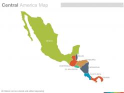 Maps of central american america region countries in powerpoint
Presenting maps of central american america region countries in powerpoint. This is a maps of central american america region countries in powerpoint. The stages in this process are mexico, guatemala, el salvador, belize, honduras, nicaragua, costa rica, panama.


